Mapping the Future: LRC Brings Cutting-Edge Scanning to Loureiro
December 12th, 2025
Enhancing design accuracy with powerful 3D scanning and mapping tools
With LRC Group joining forces with Loureiro, our teams gain access to advanced scanning, surveying, and SUE capabilities that are transforming how complex infrastructure projects are planned and executed. From high-definition 3D laser scanning to detailed subsurface mapping, LRC’s expertise gives engineers a clearer understanding of existing conditions, reducing risk and improving design accuracy from day one. Their experience and cutting-edge technology strengthen our growing geospatial services and position Loureiro to deliver even more precise, efficient, and innovative solutions.
When a highway project in western New York faced the challenge of connecting new infrastructure to existing bridges and tunnels, traditional surveying methods would have meant costly surprises during construction. Instead, the DOT turned to 3D laser scanning, saving $35 million in cost overruns while finishing ahead of schedule.
When LRC Group joined the Loureiro team on October 31, we gained access to the experience and technology that make outcomes like this possible. With offices in Connecticut, New York, New Jersey, and New Hampshire, LRC brings decades of surveying, scanning, and SUE expertise that are reshaping how complex infrastructure projects are designed and delivered.
Seeing in Three Dimensions
LRC began in 1999 as a civil engineering and surveying firm and has gradually expanded its services to include landscape architecture, master planning, and advanced geospatial capabilities. Over the past decade, the team has built a strong niche in high-definition 3D laser scanning and subsurface utility engineering — services that now support major energy, infrastructure, and municipal clients across the region.
Principal John Wagenblatt, LS, has been in the surveying field for 42 years and has seen the profession evolve from transits to GPS to today’s high-speed scanners. “A crew can spend a week locating all the piping on a gas compressor site,” he says. “We can scan it with survey control and be out of there in a day.”
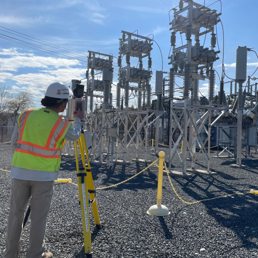
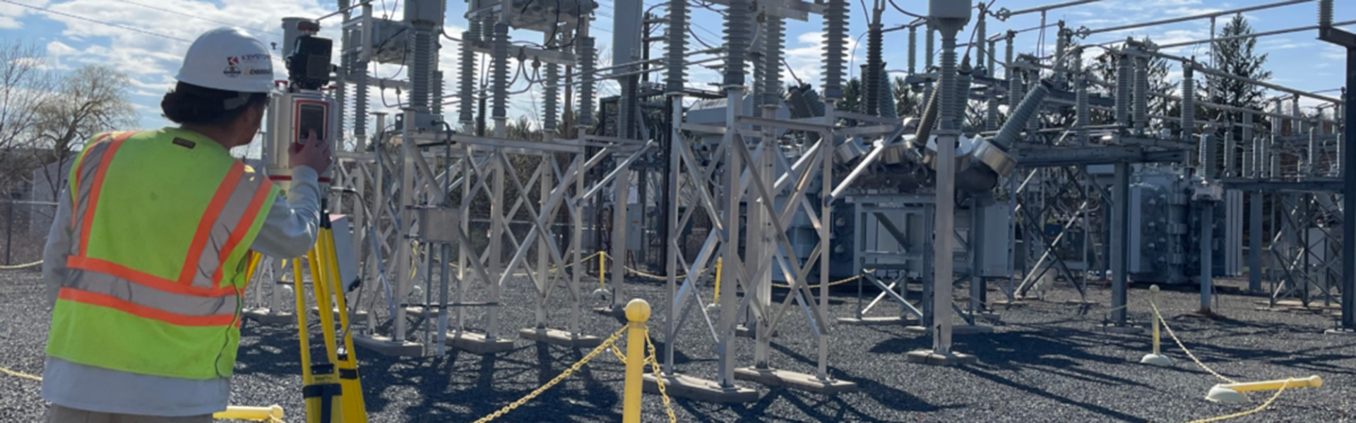
LRC’s workhorse scanners, manufactured by Riegl in Austria, collect roughly 3 million points per second to produce a detailed “point cloud” — a 3D representation of existing conditions for everything from substations and sewer treatment plants to airport facilities and historic buildings.
“We’re able to reproduce exactly what’s out there with a high degree of certainty,” Wagenblatt explains. “That allows design engineers to know exactly what they’re working with.”
From Energy Infrastructure to Underground Utilities
Much of LRC’s scanning and surveying work supports major players in the energy sector, including Eversource and Enbridge. For these clients, the team documents everything from long transmission corridors scheduled for upgrades to complex gas compressor stations where miles of above-ground pipe run through only a few acres.
For electrical substations, LRC often takes scanning a step further by building full 3D models that capture equipment, structures, and precise wire heights. This level of detail helps engineers plan new installations without taking physical measurements in challenging or hazardous environments.
LRC has also developed strong expertise in subsurface utility engineering (SUE), particularly in dense urban areas where underground space is limited. “In Boston, there’s no room left underground,” Wagenblatt explains. “We’re able to identify what’s there, and designers are squeezing conduit in places I wouldn’t think possible.”
Strengthening Our Services
For Wagenblatt and his team, joining Loureiro opens the door to expanded opportunities and support for services they’ve spent decades refining. “I’ve always believed in staying current with new technology,” he says. “We might not have been the first to buy scanning equipment, but we bought the best, and it’s paid dividends.”
For Loureiro, LRC’s expertise strengthens an already growing suite of geospatial and field services. Their experience in high-definition scanning, modeling, and SUE gives our engineers and clients a clearer picture of existing conditions — reducing risk, improving design accuracy, and supporting better decisions from the very beginning of a project. As part of Loureiro, LRC’s capabilities will help us deliver even more precise, efficient, and innovative solutions across the infrastructure and energy sectors.


